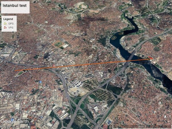
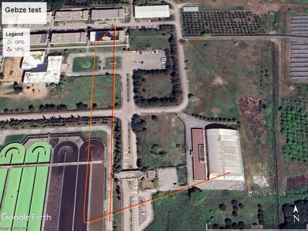
Advanced Technology

Visual Positioning System (VPS)

A system that uses camera imagery and satellite-based spatial databases for precise drone positioning and navigation.

Features

Features

Capabilities

Capabilities

Performs intelligent reconnaissance/targeting missions in areas where human presence is prohibited or impossible.
Collects and analyzes visual and thermal data in real time.
Automatically avoids obstacles and returns to the starting point, even if communication is lost.
Benefits

Benefits

Enables government agencies to monitor and analyze threats without endangering lives.
Accelerates emergency response and security and military interventions.
Enhances the ability to gather accurate, real-time information.
Status

Status

Project completed and tested in environments similar to hazardous areas.
Ready for deployment in security and defense missions.

Shopping cart

0
image/svg+xml

No products in the cart.

Continue Shopping